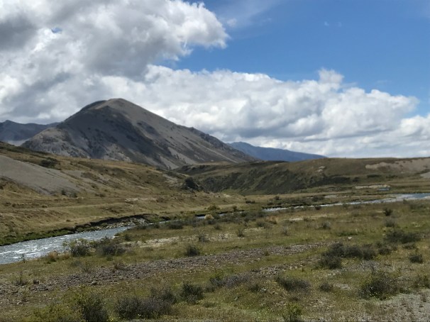
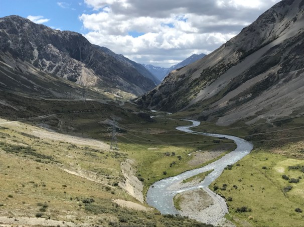
As I continue on my journey to Bluff, I found the Waiau Pass blocked by snow so I decided to take the alternate route down Rainbow Road to Hanmer Springs. This is a private road through farming country and it follows the power lines along the Wairau and Clarence Rivers between St Arnaud and Hamner Springs. It’s definitely a beautiful route but 112km of tough road walking.
Since I never found a definitive tramper’s guide for this route, I thought I’d put one together to help future trampers along the way!
A few things of note, there is PLENTY of water along the way so noting water points would take too much time. Also, the first 37km out of St Arnaud are all private land and camping is prohibited. It’s a long but beautiful walk to the first hut along the route. Finally, there are other DoC trails and huts along this route that are several hours off the main route. Because this guide is aimed at people going straight through to Hamner Springs, I have not included them in this guide.

Km 0 – St Arnaud General Store – proceed East/North East towards Rainbow Road along Highway 63.
Km 9 – Turn right onto Rainbow Road
Km 26 – Turnoff for Rainbow Ski Field (keep going straight – I’ve included this as a reference point only)
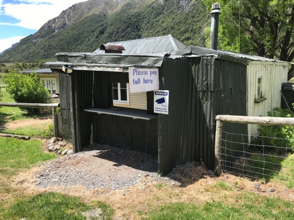
Km 36 – Rainbow Road toll gate – trampers are free but a permit is required
Km 37 – Turnoff for Conners Creek Hut. A 6 Bunk DoC hut. Long drop toilet and creek for water supply. Hut is about 1km off the road. Level walk along 4WD track.
Km 46 – Coldwater Creek Campsite. Long drop toilet and creek for water supply. Grass was knee high when I walked through here, but there is lots of tent space.
After this point, there are few trees and the road is exposed to full sun. Please protect yourself with hat and/or sunscreen.
Km 57 – Sedgemere Sleepout. A 6 bunk DoC hut about 1 minute walk from the road. Long drop toilet and water supplied by tank.
Km 63 – Island Gully Hut. A 4 bunk DoC hut. Hut is a 5 minute walk off the road along a 4WD track. Long drop toilet and creek for water supply. This is a cattle grazing area so treat water before drinking.
Km 68 – Island Saddle. This is the highest point on the road at 1347 meters above sea level.
Km 73 – Lake Tennyson. There is a turn here and 1.5km up the road is Lake Tennyson. Camping and toilets available.
Km 75 – St James Cycleway Entrance. Long drop toilet and looked like room for tents.
Km 85 – Fowler’s Camp. Historic DoC hut and long drop toilet. Plenty of tent space as well. River for water supply. I did not explore the hut, but I understand it does not have bunks.
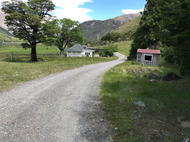
Km 101 – St James Homestead. Free camping and toilets available.
Km 104 – Turn right to reach Hamner Springs
Km 112 – Enter Hamner Springs.
I hope this guide helps future trampers. My biggest difficulty was knowing how far each point was along the way without measuring my maps. The road is very lightly traveled so expect a very remote experience!
If you’re enjoying my adventures, please consider supporting me through Patreon

Just found out about your website. Amazing stuff. Read a bunch of posts. Sounds like a trip of a lifetime. I’ll check in again and in the meantime, hope you have plenty of sunshine and Merry Christmas down under.
LikeLike
It’s really amazing here. I’m definitely enjoying a Kiwi lifestyle, but it will be nice to get home! Merry Christmas to you too!
LikeLike